Te Pātukurea – Kerikeri-Waipapa Spatial Plan Growth Scenarios Engagement
Update: The submission period has now closed. We will update this page as the project progresses.
Guide our future together
Help us select the best growth scenario for Kerikeri-Waipapa.
We’re developing Te Pātukurea, a spatial plan that will shape how Kerikeri and Waipapa grow and develop over the next 30 years.
This plan will influence:
- The look and feel of our communities
- Where and how we live
- How we get around
- Where we work
- How we protect and care for our environment.
We’ve created six possible growth scenarios for Kerikeri-Waipapa’s future. Now, we need your input to help select the best path forward!
Whether you’re a resident, business owner, part of a community group or have an interest in the region, your feedback is crucial.
Explore the Growth Scenarios
See the Growth Scenarios Report here.
*We have corrected a minor error for Scenarios B and E where dollar signs were missing from some cost estimates and uploaded updated report 20.11.2024.
View an interactive Have your Say map of the growth scenarios here.
You will be able to add your comments anonymously and see what other people are saying.
Find out more about each growth scenario below:
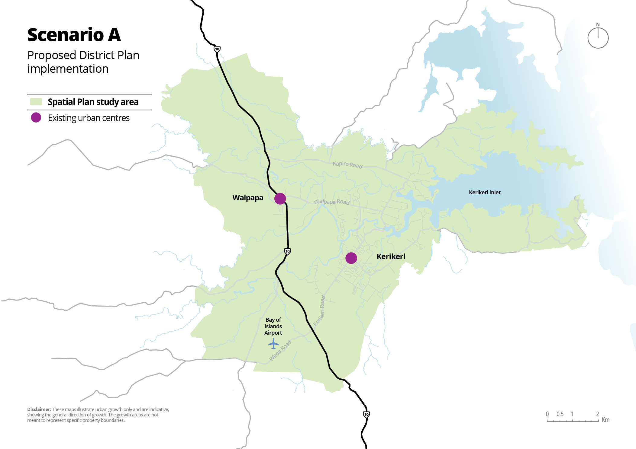
This scenario maximises development opportunities within Kerikeri and directs industrial growth (areas for factories, warehouses, or other large-scale businesses) to Waipapa. Areas around Kerikeri and along Waipapa Road will be zoned as Rural Residential with the potential for future re-zoning (changing the land's use from rural to urban, like housing or businesses) as demand increases.
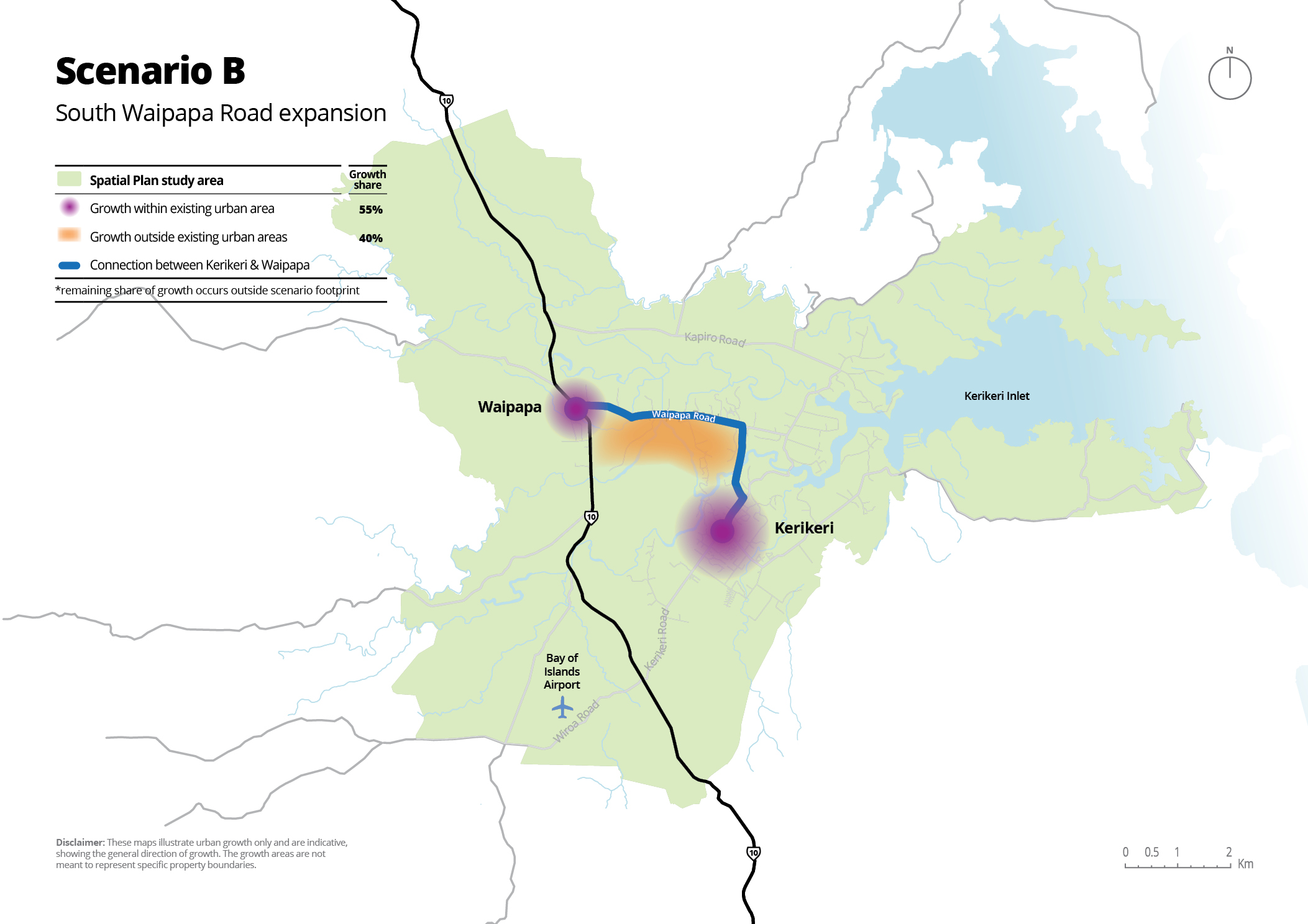
This scenario proposes enabling urban growth south of Waipapa Road, in addition to intensifying (adding more homes and businesses in already-built areas, making better use of space) development in the established centres of Kerikeri and Waipapa.
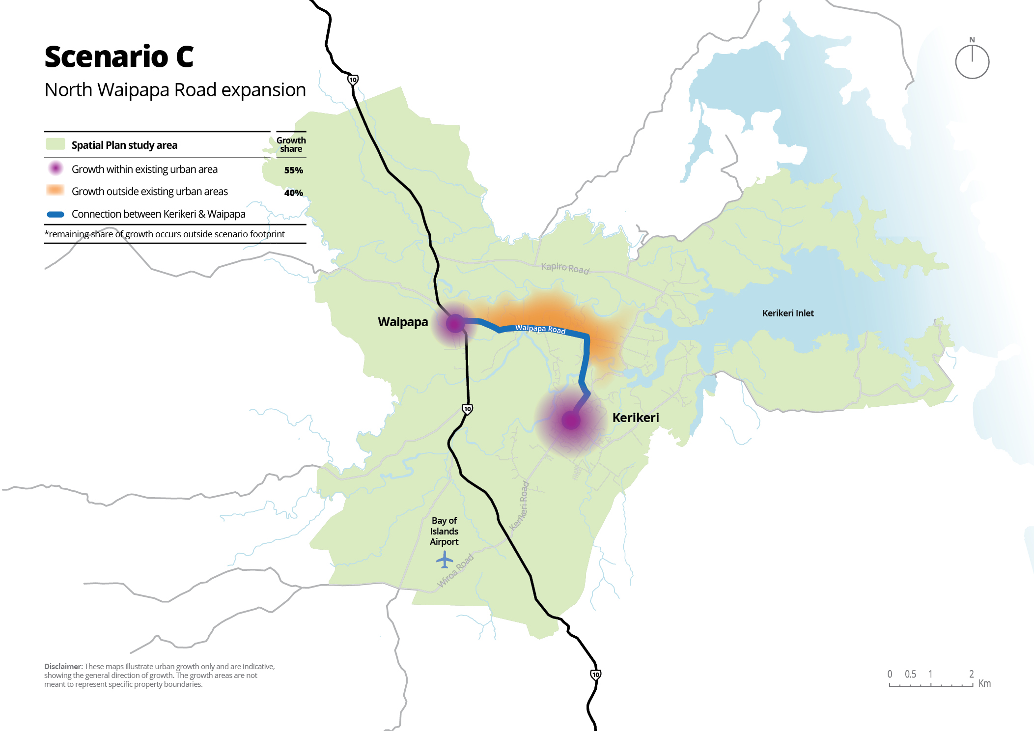
This scenario proposes enabling urban growth north of Waipapa Road, in addition to intensifying (adding more homes and businesses in already-built areas, making better use of space) development in the established centres of Kerikeri and Waipapa.
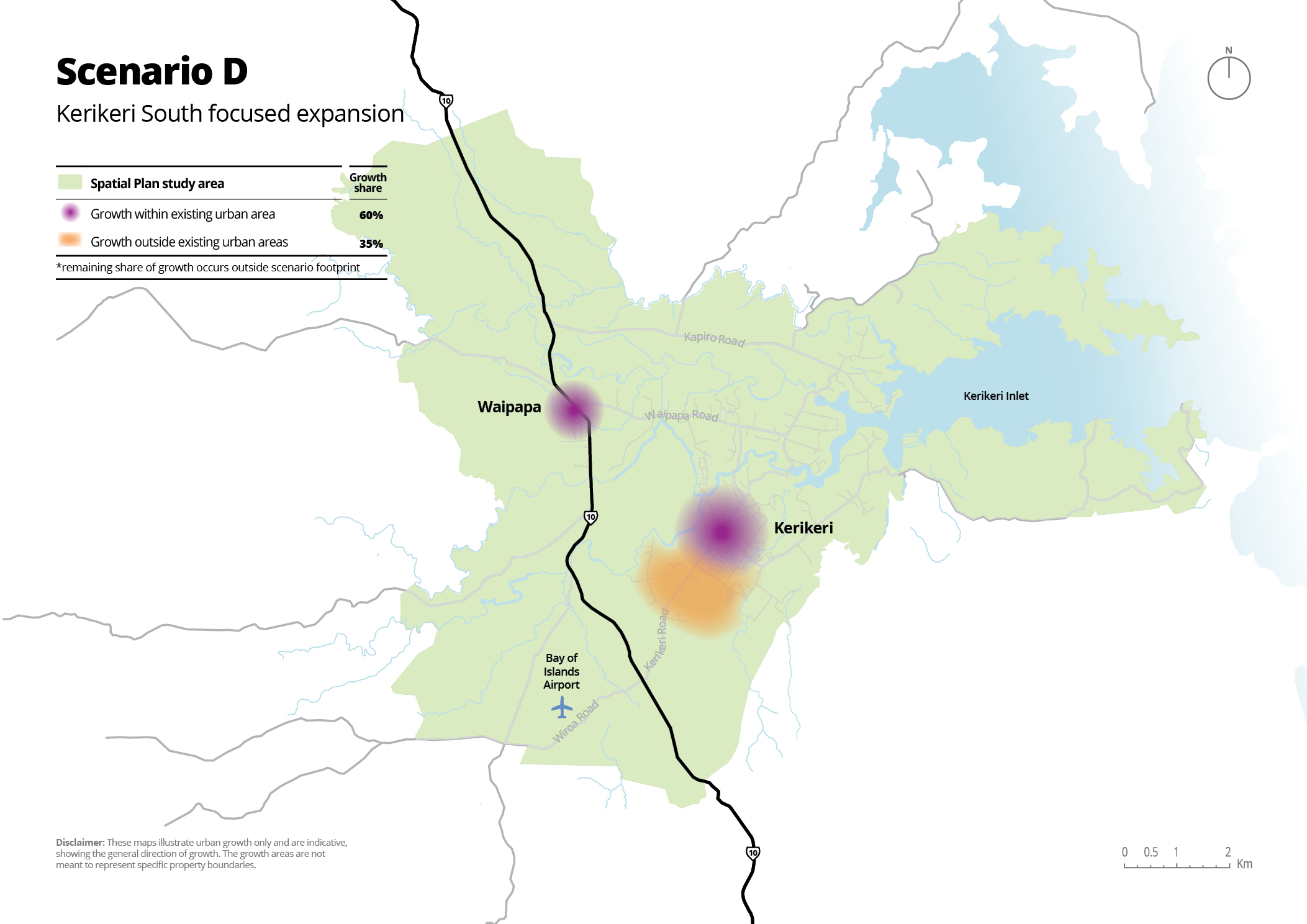
This scenario proposes greater intensification within Kerikeri's existing urban area and focused development to the south of Kerikeri, building on existing infrastructure (like water, sewer systems, stormwater drains and roads) while adding more housing and facilities in the southern parts of the town.
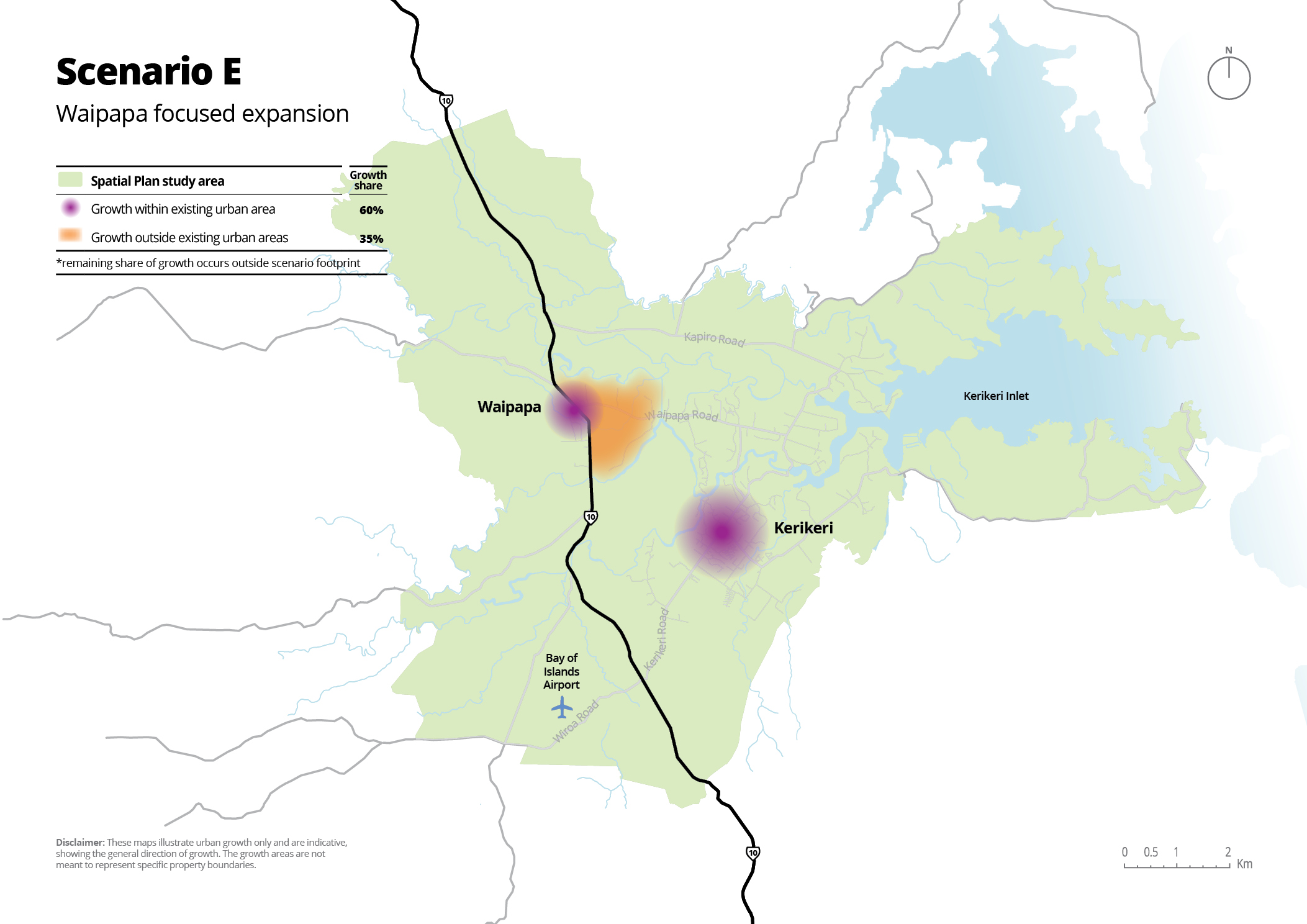
This scenario concentrates development around Waipapa, promoting growth in this area with a mix of housing, commercial, and community spaces. It focuses on building a stronger, more centralised community in Waipapa.
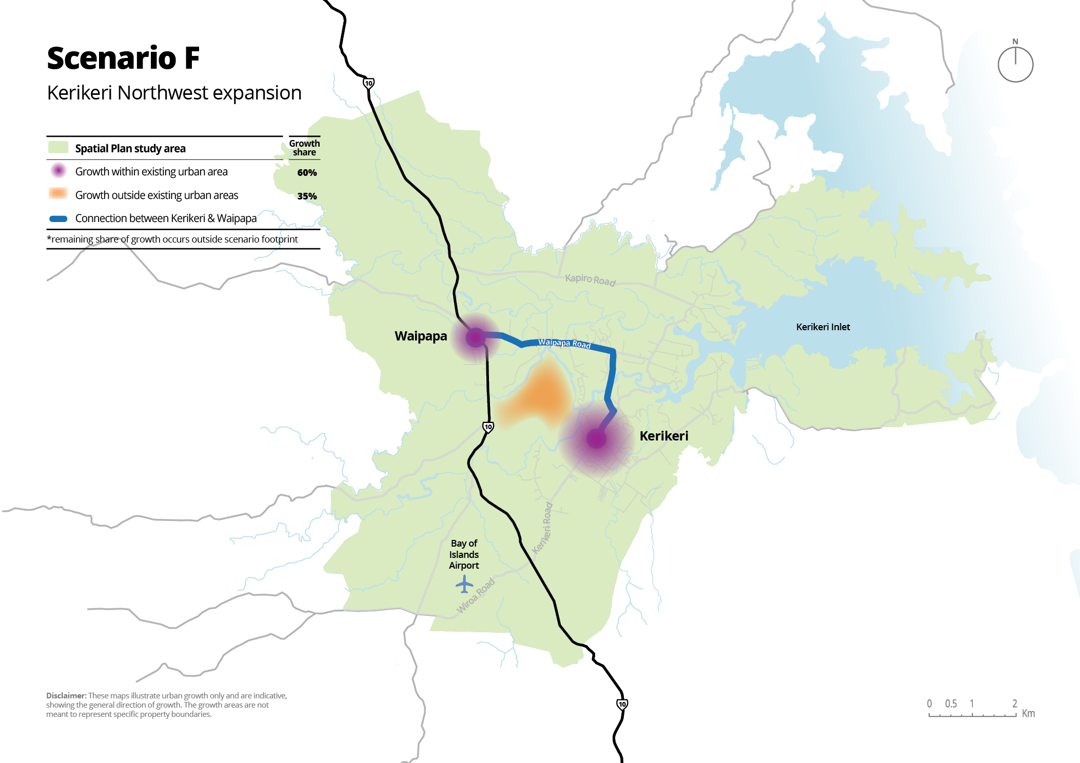
This scenario envisions greenfield growth (building on previously undeveloped land) to the northwest of Kerikeri's urban area. It prioritises new developments on vacant land, expanding residential and commercial areas in this region.
How to Have Your Say
We want your feedback! Here’s how you can share your thoughts:
- Online survey: Click here to share your feedback through the survey
- Interactive Have your Say map: [Click here to drop your pin on an interactive map and leave comments on the growth scenarios]
- Attend a pop-up event:
- Procter Library, Kerikeri: 7 November, 10 am – 2 pm
- Waimate North Show: 9 November
- Bunnings Warehouse, Waipapa: 13 November, 10 am – 2 pm
- Ngāti Rēhia Offices, 2 Aranga Road: 21 November, 4 pm – 7 pm
- BaySport Stadium: 23 November, 10 am – 2 pm
- Email us: kwsp@fndc.govt.nz
- In person: Drop off your submission form at any FNDC service centre or library. (Our friendly customer service team can print the form for you.)
- By mail: Far North District Council, Private Bag 752, Kaikohe 0440, ATTN: GPP Team
We must receive your feedback by Friday 29 November 2024.
Note: Anyone is invited to submit feedback on this consultation, whether as an individual or on behalf of an organisation, however, any submissions that are out of scope, offensive, inappropriate, or late may not be accepted by the council. You will be notified if your decision is not accepted and, where appropriate, invited to resubmit.
Any submissions that are made will become part of the public consultation process. The collection and use of personal information by the Far North District Council is regulated by the Privacy Act 2020. Please note that your submission or a summary of your submission will be treated as public information and may be published on the council's website and made available to elected members and members of the public as part of the consultation process. Your name and contact details (address, phone number, email) will only be used for administrative purposes - such as the council contacting you to update you on the outcome of this consultation and letting you know about future consultations.
Questions and Answers
No, the costs for these transport upgrades are included in all scenarios and are assumed to be the baseline transport upgrades, even though they are only explicitly listed under Scenario A. These upgrades are consistently shown across the potential upgrade maps within Appendix C of the Growth Scenarios Report.
Te Pātukurea is a sub-area spatial plan that will guide growth and development over the next thirty years across Kerikeri and Waipapa. It will identify what Kerikeri-Waipapa will look and feel like, what infrastructure is needed and when, and how we’ll meet the outcomes sought by the community. Read more here - https://www.fndc.govt.nz/tr/Whats-new/Current-projects/te-patukurea-kerikeri-waipapa-spatial-plan
Yes, all feedback will be reviewed and considered in the development of the Kerikeri Waipapa Spatial Plan. Your input is crucial in shaping our community's future.
The engagement period will be open 1st November 2024 to 29th November 2024. Be sure to submit your feedback before the deadline!
Anyone with an interest in the Kerikeri Waipapa area is welcome to participate! This includes residents, business owners, and visitors.
Feedback related to community needs and aspirations, infrastructure improvements, environmental concerns, and ideas for future developments are particularly valuable.
A summary of the feedback received will be shared with the community through our website and community meetings. Stay tuned for updates!
Our constraints include areas that contain natural hazard risks, ecological protections, land use restrictions, historic and cultural heritage protections, and significant infrastructure. You can see these areas on the Te Pātukurea Constraints Viewer and read about them in our Foundation Report.
If you have any other questions, feel free to reach out to kwsp@fndc.govt.nz.
